One of the wonders of the world ranking number eight is the Karakoram Highway mountains. Not only is this the highest elevation paved highway in the world at 4,714 meters, the Karakoram Highway also provides the best views of three mighty mountain ranges. This massive highway project started in 1962 and finished as open to the public in 1978. The Karakoram Highway is used as a connection route from Abbottabad in South Pakistan to the ancient Silk Road ending in China at Kashgar in the North. This highway plays a critical part in transporting cargo among countries stretching 1,300km (810mi). The Karakoram Highway mountains are one of the greatest tourist attractions in the world visited by domestic and international tourists. Many people come to visit the famous Karakoram Highway which has a rich history, economic value, and stunning tourism.
Fairy Meadows
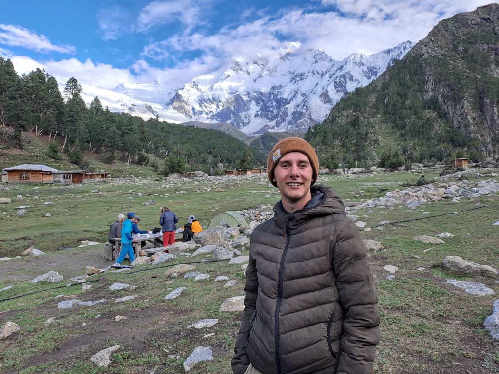
A personal favorite weekend attraction over the Karakoram Highway is the juniper forest covered resort of Fairy Meadows. The resort is famous for only having one scenic hiking trail up to the idyllic utopia at the top meaning cars and trucks cannot even visit this secluded Shangri-La. The ascending hiking trail through the thick of alpine forests uncovers a larger view of the collosal Nanga Parbat mountain. The two hour trek up to Fairy Meadows is well worth the walk to experience a completely unobstructed view of Nanga Parbat mountain standing at 8,125 meters tall covered in a thick coat of snow. The meadows from the view point of the mountain flow with horse-back riders, wood cabin lodges, and nightly campfires to exchange stories of adventure with locals underneath the crystal clear night sky. The many iconic attractions off the Karakoram Highway are the beginning chapters to exploring the life-changing journey throughout Northern Pakistan.
Karakoram Highway Construction
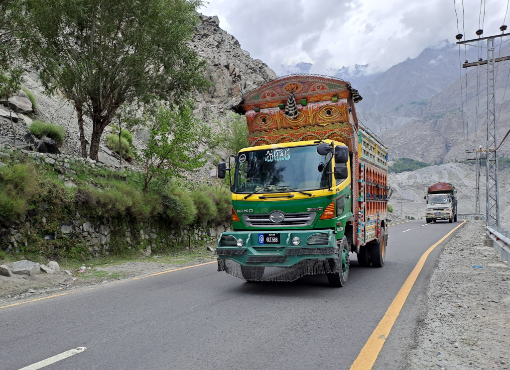
The road that stands as the Karakoram Highway today used to be a poorly structured, extremely bumpy gravel road very dangerous for traveling. In June of 2006, Pakistan and China signed a much needed agreement to rebuild and upgrade the Karakoram Highway increasing the width from 10m to 33m (33ft to 98ft). The increase in the size of the road also increased the transport capacity three fold and allowed much heavier vehicles to transport cargo in extreme weather conditions. In January of 2010, a massive landslide 15km upstream from the capital of Karimabad blocked the stream and formed a lake now known as Attabad Lake. The subsequently formed lake measured an astonishing 22km long and 100m or 330ft deep. About five months later in June, the waters began to back up above the landslide dam displacing thousands of villagers. To transport trade goods, small boats or vessels were assigned to haul cargo from one end of the lake to the other side. Pakistan started construction on a revised route around the lake including five new concrete tunnels accumulating 7km long. Since the landslide, two additional new bridges have been constructed.
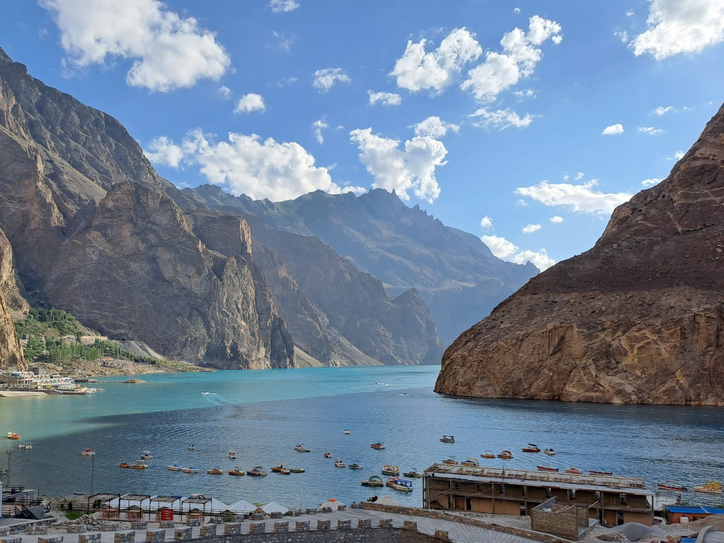
Attabad Lake on the Karakoram Highway
The formation of the Attabad Lake produced one of Pakistan’s most beautiful natural sceneries overlooking the deep, crystal turquoise waters. Today, the lake has enticed the eyes of so many domestic and international tourists that many wood cabins, local-cusines, and scenic outlooks have made this surreal lake a worthwhile stop to enjoy encompassing views and the culture of Pakistani hospitality. Looking at the lake will take your breath away but nothing compares to being on the lake itself via jet ski, speed boat, or even the ornamented wooden boats. The mesmerizing lake is overlooked by the towering Karakoram mountains often having clouds journeying over them and epic sunset evenings over the water. Upon arrival during my visit to Attabad Lake, the owner of the Pearl Hut Resort found us and invited us to socialize over a cup of hot chai. We heard his entire journey with Attabad Lake and his beautiful lodges making a real impression on us about the rich culture and history produced from the landslide that made all his work possible.
Despite landslides and floods, the Pakistani length of Karakoram Highway stands strong at 806km starting in Abbottabad continuing next to the mighty Indus River until Jaglot. Where the Gilgit River joins the Indus River, three great mountain ranges intersect each other known as, the Hindukush, the Himalayas, and the Karakoram. The road continues through the Karakoram Highway mountains, the valleys of Nagar and Hunza, along the Hunza River where Pakistani road ends at the Pakistani-Chinese border at Khunjerab Pass. The border crossing at Khunjerab Pass stands at over 4,600 meters, making it one of the highest international border crossings in the world. During a ride on the Pakistani side of the road, some of the highest mountain peaks and glaciers are completely visible, resulting in one of the most stunning views in South Asia.
The Karakoram Highway mountains are all accessible via car, jeep, or bus, making an expedition from the roadside possible for almost all peaks. In Gilgit-Baltistan and several peaks in China, lots of fresh water becomes trapped in some of the largest glaciers in the world such as the Baltoro and Siachen Glaciers. Five out of the eight Karakoram Highway mountains taller than 8,000m in Pakistan are accessible by the highway. The most notable Karakoram Highway mountains seen directly from the road are Nanga Parbat (8,126m), Rakaposhi (7,788m), Diran (7,266m), Shishpar (7611m), Ultar Peak (7,388m), and Tupopdan (6106m). There are four glaciers that can also be directly seen from Karakoram Highway comprising Minapin Glacier, Passu Glacier, Ghulkin Glacier, and Khunjerab Glacier.
In my travels over the Karakoram Highway, there was a landslide hours before my arrival to Gilgit at Ghizar. Crowds swarmed the streets and as we waited for excavators (giant cranes on wheels) to come to the landslide location. For several hours, people gathered to eat apricots, drink from barrels of water, and enjoy the show! Eventually, the excavators came to fix the blockage and the crowds scattered to their vehicles before traffic began to flow smoothly again. Landslides such as this happen frequently during the rainy season due to excess water from melting glaciers storming rocks down the mountainsides. No matter how urgent someone’s time is in Pakistan, landslides can stop any plans in a moment’s notice.
The Ancient Silk Route
Despite many landslides reshaping the mountains, the history engraved in the mountainsides has stayed preserved. The Silk Road began as a vast trade route connecting Eurasia and North Africa through various land and sea routes. During a time of increased trade, the Silk Road earned its name from the valued commodity Chinese silk being continuously traded by international merchants. The traveling merchants left behind glimpses of history from their lives in the form of petroglyphs and rock art accumulating over 50,000 pieces. Thousands of years ago along the highway, man made carvings were edged into the rocks by invaders, traders, and pilgrims trading along the route. The abstract pictures show single animals, hunting scenes, and triangular men where the animals tended to be larger than the hunters. The rich history engraved in the Karakoram Highway mountains is an intriguing key point for historic tourism.
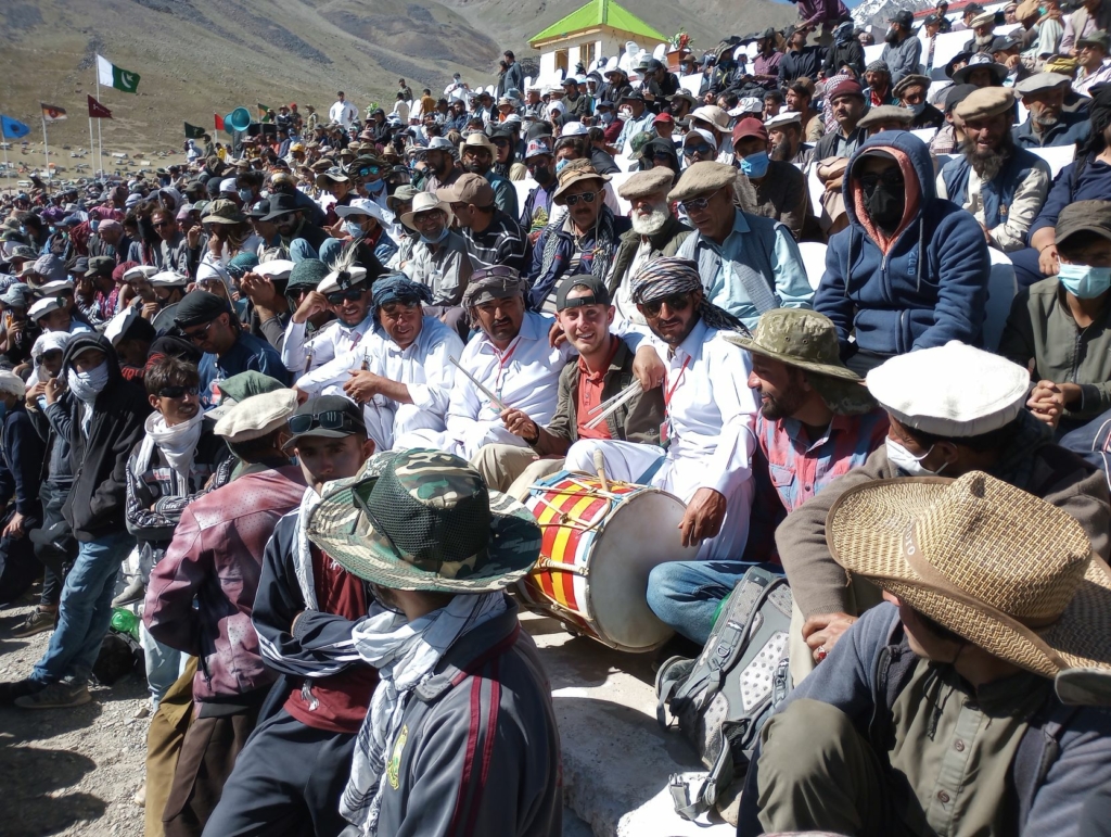
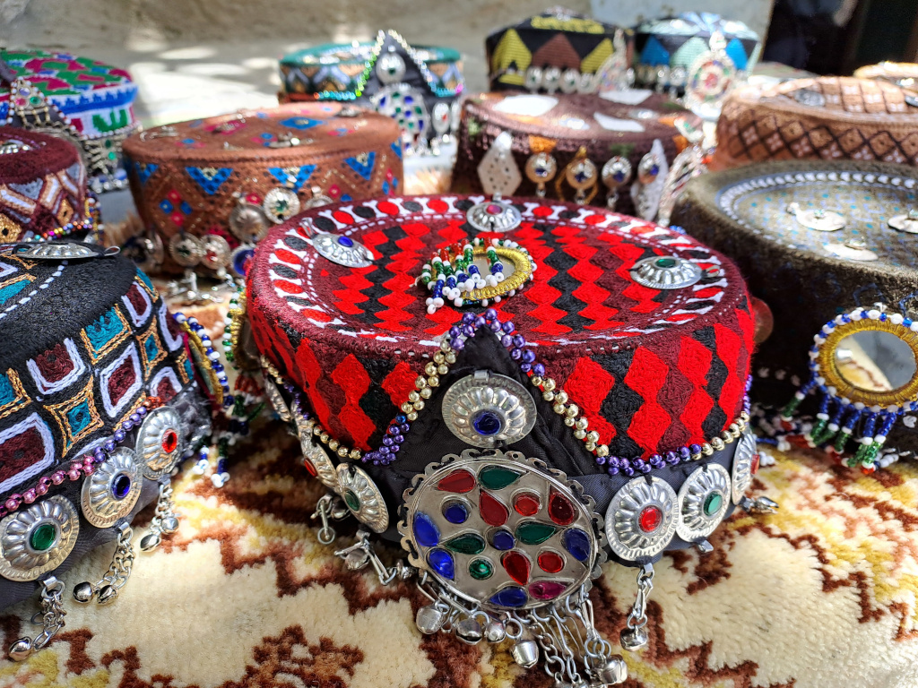
Pakistan captures the heart of specific ‘niche’ adventure travelers who are zealous for unique travel destinations despite there being more domestic than international tourists. Since 2013, the number of international tourists visiting Pakistan has almost tripled standing now at 1.75 million visitors in 2016 largely due to the improved security in the country. British daily newspaper The Guardian deems the Karakoram Highway as the third best tourism destination in Pakistan. Travelers are more attracted to the Karakoram Highway mountains than the highway itself serving as an access point to the breathtaking scenery. Cyclists, backpackers, and mountaineers fervently travel long distances to access the numerous mountain peaks, glaciers, and lakes. Some of the most famous mountaineering expeditions from Karakoram Highway are found in the cities Gilgit and Skardu.
Places to Visit in the Karakoram Mountains
Wondering what to do at Karakoram Highway? The scenic Naltar Valley off the Karakoram Highway offers many activities such as alpine skiing, trekking up mountains, climbing over glaciers and mountain passes, or enjoying the high altitude lakes. A must visit destination is Bishgiri Lake, one of the highest clear-water lakes in Pakistan. There are several ways to travel over the Karakoram Highway such as bus, jeep, or private car options traveling from Northern Pakistan, Rawalpindi and more centrally located, Lahore. Taking the bus can be akin to a roller coaster with many curvy turns and occasionally coasting near the brink of the road. It is more recommended to take a smaller vehicle such as a private car or jeep for a more secure ride. The best season for traveling to Karakoram Highway mountains is either in the Spring or early Fall due to the Summer’s monsoon season causing landslides and the Winter blocking the road with many feet of snow.
One of the most stunning views of the tallest summit peaks in the world can be viewed in Karakoram Highway mountains. The world renowned three mighty mountain ranges, the Hindukush, the Himalayas, and the Karakoram meet at one legendary intersecting location near Juglot. With rich history, vast natural scenery, and the most epic mountains in the world, Karakoram Highway earns its place as one of the top tourist destinations in all of Pakistan. The first stop for any mountaineering expenditures, trekking adventures, or photography enthusiasts is at the viewpoint of 9 of the 10 highest peaks in the world accessible on Karakoram Highway. Adventure is calling to explore and discover the most majestic mountains and attractions in the world! If you are thinking about taking on one of the most epic road trips available, be sure to see the Karakoram Highway Itinerary for more travel advice.